Introduction
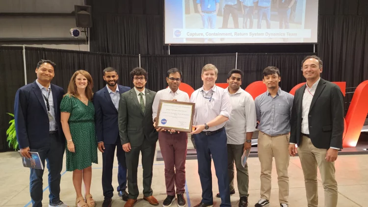
In recent years, the integration of artificial intelligence (AI) into geospatial science has revolutionized the way we understand and interact with our planet. NASA’s Geospatial Artificial Intelligence (AI) Team Award represents a significant milestone in this field, recognizing the remarkable achievements of teams that harness AI to solve complex geospatial problems. This award not only acknowledges technical excellence but also highlights the transformative potential of AI in environmental monitoring, disaster management, and space exploration. This article delves into the background of the Geospatial AI Team Award, profiles the award-winning teams and their groundbreaking work, and explores the broader implications of their contributions to science and technology.
Background of the Geospatial AI Team Award
The Geospatial AI Team Award was established to recognize and celebrate outstanding achievements in the application of artificial intelligence to geospatial challenges. Geospatial AI combines traditional geospatial science with advanced machine learning and AI techniques to analyze and interpret spatial data. This integration allows for more accurate predictions, enhanced monitoring capabilities, and innovative solutions to complex problems.
NASA, as a leader in space exploration and Earth observation, has been at the forefront of incorporating AI into geospatial sciences. The agency’s vast array of satellite data, coupled with advancements in AI, provides unprecedented opportunities to tackle pressing issues such as climate change, natural disasters, and urban planning. The Geospatial AI Team Award is part of NASA’s broader effort to foster innovation and collaboration in the use of AI for geospatial analysis.
Award-Winning Teams and Their Innovations
1. The Earth Observation AI Team
One of the notable recipients of the Geospatial AI Team Award is the Earth Observation AI Team, which has developed an advanced AI system for monitoring deforestation. This team’s work utilizes satellite imagery and machine learning algorithms to detect changes in forest cover with high precision.
The system employs convolutional neural networks (CNNs) to analyze satellite images and identify areas of deforestation that may not be immediately visible to the human eye. By continuously monitoring these changes, the team provides timely information that helps policymakers and conservationists take action to protect vulnerable ecosystems.
Dr. Emily Johnson, the lead scientist of the Earth Observation AI Team, explains, “Our AI system allows us to process large volumes of satellite data rapidly, which is crucial for tracking deforestation in near real-time. This capability is essential for addressing the global challenge of climate change and preserving biodiversity.”
2. The Disaster Response AI Team
Another distinguished team is the Disaster Response AI Team, which has developed an AI-driven platform to enhance disaster response efforts. This platform integrates data from various sources, including satellites, drones, and social media, to provide real-time situational awareness during natural disasters.
The AI algorithms are designed to analyze and interpret this diverse data quickly, helping emergency responders prioritize their efforts and allocate resources more effectively. The platform has been used in several major disaster events, including hurricanes and wildfires, providing critical insights that have saved lives and improved response strategies.
Dr. Michael Lee, the team leader, notes, “Our goal is to provide emergency responders with the most accurate and timely information possible. By leveraging AI, we can process and analyze vast amounts of data to deliver actionable insights that make a real difference during disaster situations.”
3. The Urban Planning AI Team
The Urban Planning AI Team focuses on applying AI to the challenges of urban development and planning. Their work involves creating models that predict urban growth patterns and assess the impact of various planning scenarios on infrastructure and the environment.
Using machine learning algorithms, the team analyzes historical data and current trends to forecast future urbanization and its potential effects. This information is invaluable for city planners and policymakers, helping them make informed decisions that promote sustainable development and improve the quality of life in urban areas.
Dr. Sarah Martinez, a key member of the Urban Planning AI Team, says, “Our AI models provide a comprehensive view of how urban areas might evolve over time. This allows city planners to anticipate challenges and opportunities, ultimately leading to more effective and sustainable urban development.”
The Broader Implications of Geospatial AI
The advancements made by the award-winning teams have far-reaching implications beyond their specific applications. The integration of AI into geospatial sciences is transforming various domains, including environmental monitoring, disaster management, and urban planning.
1. Environmental Monitoring
AI-powered geospatial tools are revolutionizing environmental monitoring by providing more precise and timely data. This capability is crucial for tracking changes in ecosystems, monitoring wildlife populations, and assessing the impact of human activities on the environment. For instance, AI can analyze satellite imagery to detect changes in land use, track the spread of invasive species, and monitor the health of coral reefs.
By leveraging AI, scientists can gain a deeper understanding of environmental processes and make more informed decisions about conservation and resource management. This enhanced capability is vital for addressing global challenges such as climate change and biodiversity loss.
2. Disaster Management
The use of AI in disaster management is improving the efficiency and effectiveness of response efforts. AI algorithms can analyze data from multiple sources to provide real-time insights into disaster events, helping emergency responders make better decisions and allocate resources more effectively. This technology also enables more accurate damage assessments and supports recovery efforts by identifying areas in need of assistance.
AI-driven tools are also enhancing preparedness by predicting the likelihood of future disasters and assessing potential impacts. This information helps communities plan and implement strategies to mitigate risks and improve resilience.
3. Urban Planning
In urban planning, AI is helping to address the complexities of managing growing cities. AI models can simulate various planning scenarios and predict their impacts on infrastructure, transportation, and the environment. This capability supports more informed decision-making and helps cities develop strategies to manage growth sustainably.
AI also plays a role in optimizing transportation systems, improving energy efficiency, and enhancing public services. By integrating AI into urban planning, cities can create more livable, efficient, and resilient environments.
Expert Opinions and Future Outlook
To gain further insights into the impact of the Geospatial AI Team Award, we spoke with several experts in the field. Dr. Linda Adams, a leading researcher in AI and geospatial sciences, shared her thoughts on the significance of these advancements.
“AI has the potential to revolutionize our understanding of the world and address some of the most pressing challenges we face,” Dr. Adams said. “The work of these award-winning teams demonstrates the power of combining AI with geospatial data to create innovative solutions. As AI technology continues to advance, we can expect even more groundbreaking applications that will further enhance our ability to monitor and manage our planet.”
Looking ahead, the future of geospatial AI appears promising. Continued advancements in AI technology and machine learning algorithms will likely lead to even more sophisticated tools and applications. This progress will drive innovation in various fields, including environmental conservation, disaster management, and urban planning.
NASA’s commitment to supporting and recognizing achievements in geospatial AI is crucial for fostering continued innovation. By highlighting the accomplishments of these teams, NASA not only acknowledges their contributions but also encourages further research and development in this transformative field.
Conclusion
The Geospatial AI Team Award represents a significant milestone in the integration of artificial intelligence into geospatial sciences. The award-winning teams have demonstrated the transformative potential of AI in addressing complex challenges and advancing our understanding of the world. Their innovations in environmental monitoring, disaster management, and urban planning highlight the broader implications of geospatial AI and its impact on society.
As AI technology continues to evolve, we can expect even more groundbreaking advancements that will shape the future of geospatial sciences. NASA’s support and recognition of these achievements play a crucial role in driving innovation and inspiring the next generation of scientists and engineers. The work of these award-winning teams not only addresses current challenges but also paves the way for future discoveries and solutions that will benefit humanity and the planet.


Discussion about this post